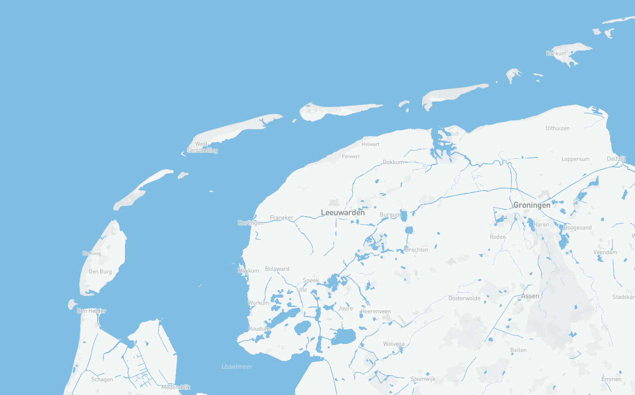
Zones volgens EU Gemeenschappelijk Visserijbeleid
Gebieden in de Territoriale Zee: Zone 0-3 Mijl zonder toegang volgens het Gemeenschappelijk Visserijbeleid (GVB), Zone 0-6 Mijl zonder toegang volgens het Gemeenschappelijk Visserijbeleid (GVB), Zone 3-12 Mijl met toegang volgens het Gemeenschappelijk Visserijbeleid (GVB), Zone 6-12 Mijl met toegang volgens het Gemeenschappelijk Visserijbeleid (GVB).
Simple
- Date (Creation)
- 2010-12-08
- Status
- On going
- GEMET – INSPIRE themes, version 1.0
-
-
Gemeenschappelijk Visserijbeleid
-
Kaderrichtlijn Water
-
Zones
-
- Use constraints
- Geen gebruiks limitaties
- Access constraints
- Copyright
- Use limitation
-
Geen gebruiks limitaties
- Denominator
- None
- Metadata language
- Nederlands; Vlaams
- Topic category
-
- Menselijke medegebruik
))
- Unique resource identifier
- EPSG:4258
- Distribution format
-
-
gml+xml
(
3.2.1
)
-
gml+xml
(
3.2.1
)
- OnLine resource
-
Wadden viewer
(
WWW:LINK-1.0-http--link
)
Bekijk deze data via de Wadden viewer
- OnLine resource
-
Inspire Geoportaal
(
WWW:LINK-1.0-http--link
)
Metadata op het Inspire Geoportaal
- OnLine resource
-
Download
(
WWW:LINK-1.0-http--link
)
Download de data via de Wadden viewer
- OnLine resource
-
ManagementRestrictionOrRegulationZone
(
OGC:WMS
)
WMS
- OnLine resource
-
am:ManagementRestrictionOrRegulationZone
(
OGC:WFS-1.0.0-http-get-capabilities
)
WFS
- Hierarchy level
- Dataset
Conformance result
- Date (Publication)
- 2010-12-08
- Explanation
-
This data set is conformant with the INSPIRE Implementing Rules for the interoperability of spatial data sets and services
- Pass
- Yes
- Statement
-
Ministerie van Defensie, Koninklijke Marine, Dienst der Hydrografie
- File identifier
- JPKfhUFsTnulVfvkASnNaQ XML
- Metadata language
- Nederlands; Vlaams
- Character set
- UTF8
- Hierarchy level
- Dataset
- Date stamp
- 2024-09-24
- Metadata standard name
-
ISO19115
- Metadata standard version
-
Nederlands metadata profiel op ISO 19115 voor geografie 2.0.0
Overviews
Spatial extent
Provided by