 Waddenregister
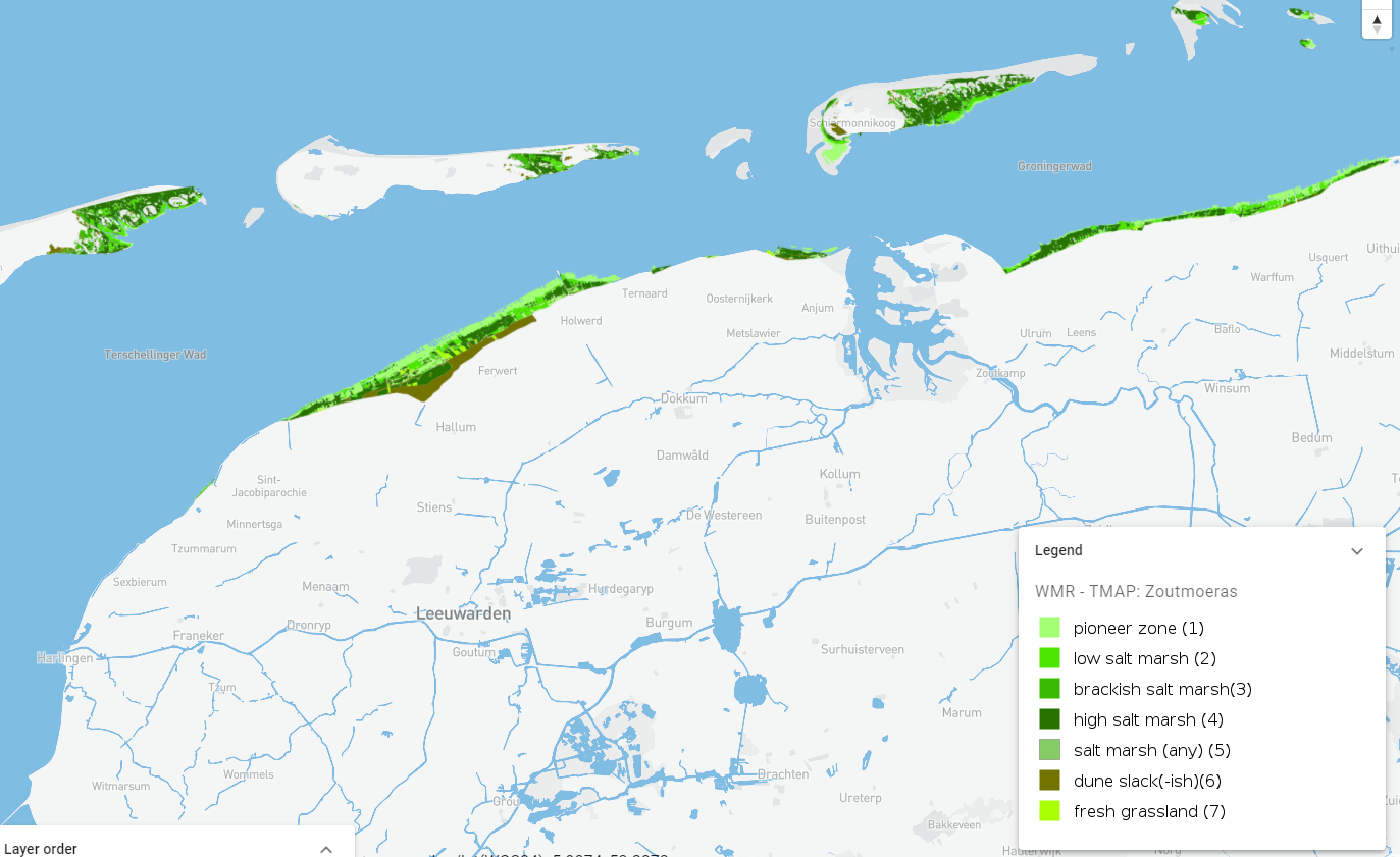
WMR - TMAP: Zoutmoeras
Langs de vastelandskust van Groningen en Friesland liggen circa 6000 ha kwelders die landelijk en internationaal van groot belang zijn in het Natura 2000 netwerk. Ze zijn onderdeel van de trilaterale Waddenzee waarvoor nationale en internationale natuurdoelen gelden, en die de UNESCO Werelderfgoed status heeft. Kwelders zijn dynamische ecosystemen met een hoge natuurwaarde vanwege de unieke zouttolerante planten en dieren die er voorkomen. Daarnaast vormen ze een geleidelijke overgang tussen water en dijk, en hebben ze een rol in de kustbescherming.
Simple
- Date (Publication)
- 2023-01-01
- Status
- Completed
- Point of contact
-
Organisation name Individual name Electronic mail address Role Wageningen Marine Research
Resource provider
- GEMET – INSPIRE themes, version 1.0
-
-
TMAP
-
Trilaterale Waddenzee
-
UNESCO Werelderfgoed
-
Ecosystemen
-
Natuurwaarde
-
Kwelderstructuur
-
- Use constraints
- Geen gebruiks limitaties
- Access constraints
- OtherRestrictions
- Use limitation
-
Geen gebruiks limitaties
- Denominator
- None
- Language
- Nederlands; Vlaams
- Topic category
-
- Biotisch
- Distribution format
-
Name Version gml+xml 3.2.1
- OnLine resource
-
Protocol Linkage Name WWW:LINK-1.0-http--link
https://viewer.openearth.nl/wadden-viewer/?layers=93966612&layerNames=WMR%20-%20TMAP%3A%20Zoutmoeras&folders=93790295,93793330,93793344,93795018,93795238,143810679,93791597,93790346,93791002 Wadden viewer
WWW:LINK-1.0-http--link
https://www.wur.nl/nl/onderzoek-resultaten/onderzoeksinstituten/marine-research/show-marine/tmap-kwelders.htm WMR
WWW:LINK-1.0-http--link
https://viewer.openearth.nl/wadden-viewer/download/geoserver?layers=93966612 Download
OGC:WMS
https://opengeodata.wmr.wur.nl/geoserver/WS3shp/wms ws3_ecotope_mp_salt_marsh
OGC:WFS-1.0.0-http-get-capabilities
https://opengeodata.wmr.wur.nl/geoserver/WS3shp/wfs WS3shp:ws3_ecotope_mp_salt_marsh
- Hierarchy level
- Dataset
Conformance result
- Date (Publication)
- 2010-12-08
- Explanation
-
This data set is conformant with the INSPIRE Implementing Rules for the interoperability of spatial data sets and services
- Pass
- Yes
- Statement
-
Data afkomstig van WMR tbv TMAP.
Metadata
- File identifier
- D9N_OpZ7QmO-e35iM2HeQQ XML
- Metadata language
- Nederlands; Vlaams
- Character set
- UTF8
- Hierarchy level
- Dataset
- Date stamp
- 2024-08-22
- Metadata standard name
-
ISO19115
- Metadata standard version
-
Nederlands metadata profiel op ISO 19115 voor geografie 2.0.0
- Metadata author
-
Organisation name Individual name Electronic mail address Role Wageningen Marine Research
pointofcontact