 Waddenregister
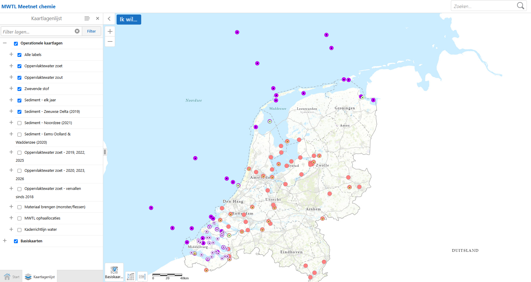
MWTL Meetnet chemie
Voor het programma Monitoring Waterstaatkundige Toestand des Lands (MWTL) zijn in de zoete en zoute Nederlandse rijkswateren een morfologisch, waterkwantiteit, chemisch, biologisch (inclusief zwemwater) en een afval meetnet ingericht. De data van het MWTL-monitoringprogramma worden gebruikt voor operationeel waterbeheer, bepalen trends, toetsing aan normen en het leveren van nationale en internationale rapportages.
Simple
- Date (Publication)
- 2025-09-30
- Status
- On going
- GEMET – INSPIRE themes, version 1.0
-
-
MWTL
-
Meetnet
-
Chemie
-
Waterkwantiteit
-
Chemisch
-
Biologisch
-
- Use constraints
- Copyright
- Access constraints
- Copyright
- Use limitation
-
Geen gebruiks limitaties
- Metadata language
- Nederlands; Vlaams
- Distribution format
-
-
gml+xml
(
3.2.1
)
-
gml+xml
(
3.2.1
)
- OnLine resource
-
Rijkswaterstaat
(
WWW:LINK-1.0-http--link
)
Achtergrondinformatie MWTL
- OnLine resource
-
Rijkswaterstaat
(
WWW:LINK-1.0-http--link
)
MWTL Meetnet chemie viewer
- OnLine resource
-
Rijkswaterstaat
(
WWW:LINK-1.0-http--link
)
In Waterinfo kunt u actuele, verwachte én historische meetgegevens over Rijkswateren van Rijkswaterstaat opzoeken.
- Hierarchy level
- Service
Conformance result
- Date (Publication)
- 2010-12-08
- Explanation
-
This data set is conformant with the INSPIRE Implementing Rules for the interoperability of spatial data sets and services
- Pass
- Yes
- Statement
-
Kaarten afkomstig uit verschillende archieven
- File identifier
- 7071a8b3-b883-4442-9518-fbccd1370516 XML
- Metadata language
- Nederlands; Vlaams
- Character set
- UTF8
- Hierarchy level
- Dataset
- Date stamp
- 2024-08-22
- Metadata standard name
-
ISO19115
- Metadata standard version
-
Nederlands metadata profiel op ISO 19115 voor geografie 2.0.0